


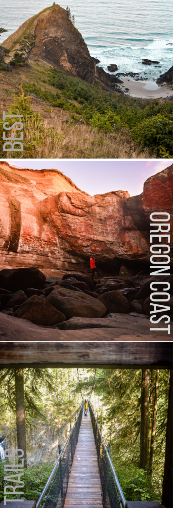
There is plenty to discover along the Oregon Coast – and by far my favorite way to see it all is by way of the trails. Unbeknownst to me on my first visit, the Oregon Coast highway is lined with scenic and unique hikes. Some are along the coast, a few are through valleys, and others trek through Oregon’s beautiful temperate rainforests.
Note that ALL of these trails are DOG-FRIENDLY but leashes are required.
In this post, I’ll take you through my top 10 favorite hiking trails along the Oregon Coast – from South to North. Let’s hit the trails!
NOTE: There is a map embedded at the bottom of this post for your convenience 🙂

Related: Best Quick Stops Along the Oregon Coast Highway
1. Samuel H. Boardman State Park
This State Park is packed full of gorgeous (and mostly short!) hikes. It’s definitely a must-see on any Oregon Coast itinerary. The photo above was taken from the parking lot of Arch Rock viewpoint, after we returned from our hike to Secret Beach.
NOTE: Samuel H. Boardman State Park also has plenty of viewpoints you can drive up to – for those not interested in hiking.

2. Sisters Rock
Sisters Rock was definitely one of my favorite hikes along the coast – possibly THE favorite. Not only because it’s short and sweet (which is quite nice when you only just woke up a half hour ago) but also because of the endless beauty we discovered there.
There are so many beautiful vantage points on this trail, and I’d encourage you to set time aside to explore off-trail a bit (but as always, only go as far as you’re comfortable going). We followed the trail all the way down and found a secret beach and an awesome, hidden sea cave. The Sisters aren’t the only highlight of this trail!
NOTE: The mound I’m standing on in the photo above is not one of the Sisters, but is a great view point of the waves crashing below and the two Sisters to my left. The actual Sisters are pictured in the very first photo of this blog post.
TRAIL INFO
Distance: 0.9 miles
Elevation: 180 feet
Trail Type: Out & Back
Difficulty: Easy
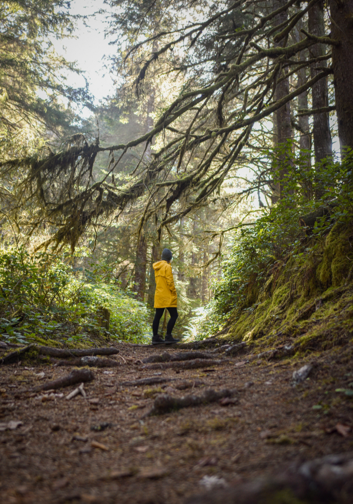
3. Hobbit Trail (to Hobbit Beach)
Yes, this trail leads you to a beach. No, it is not the most enticing part of this trail. What really made this hike one of my top Oregon Coast trails was the mossy forest we trekked through to get TO the beach. The trees were so lush and beautiful and we hardly saw a soul along the trail. Definitely a nice break from the usual busy-ness of the Oregon Coast.
NOTE: To access the beach you have to hike across the Oregon Coast highway.
TRAIL INFO
Distance: 4.6 miles
Elevation: 364 feet
Trail Type: Loop
Difficulty: Moderate
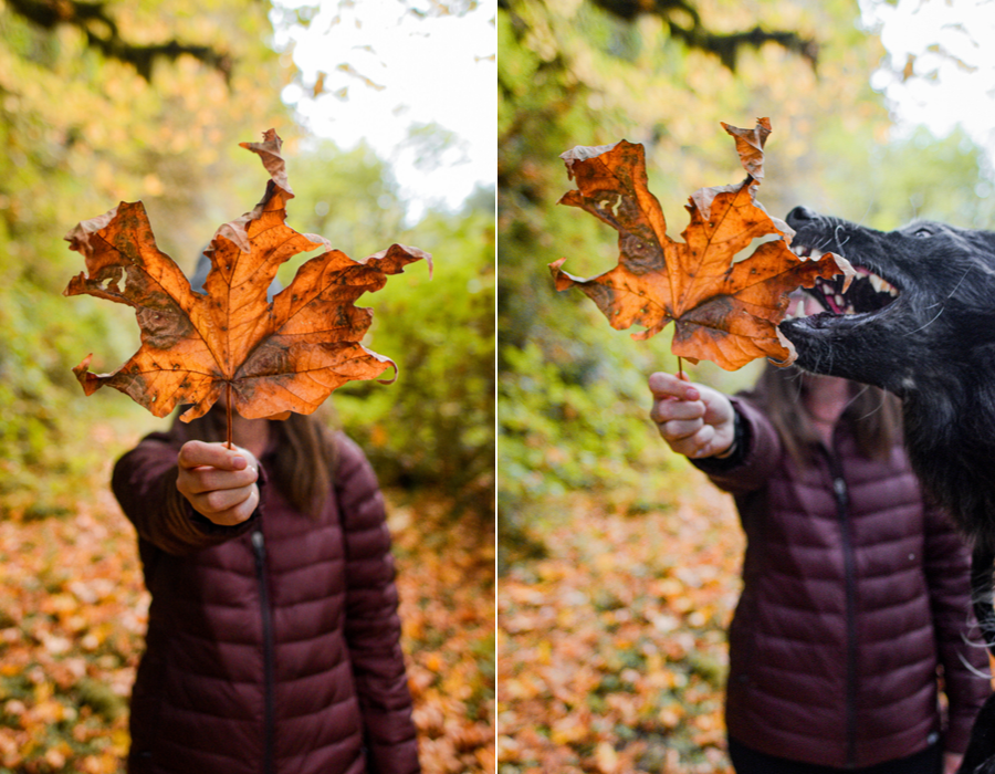
4. Enchanted Valley
This was far and away one of the most secluded trails we did along the coast. Granted, it is a bit more out of the way than the others, but it’s definitely worth the detour off Highway 101.
This trail definitely lives up to its name. The Enchanted Valley Trail takes you through an open valley, across little wooden bridges and through mossy forests until you reach the final destination – a scenic lake. My favorite part of the hike? Definitely the leaves. I think Tuna enjoyed them just as much as me, but maybe for different reasons.
TRAIL INFO
Distance: 4.8 miles
Elevation: 206 feet
Trail Type: Out & Back
Difficulty: Easy
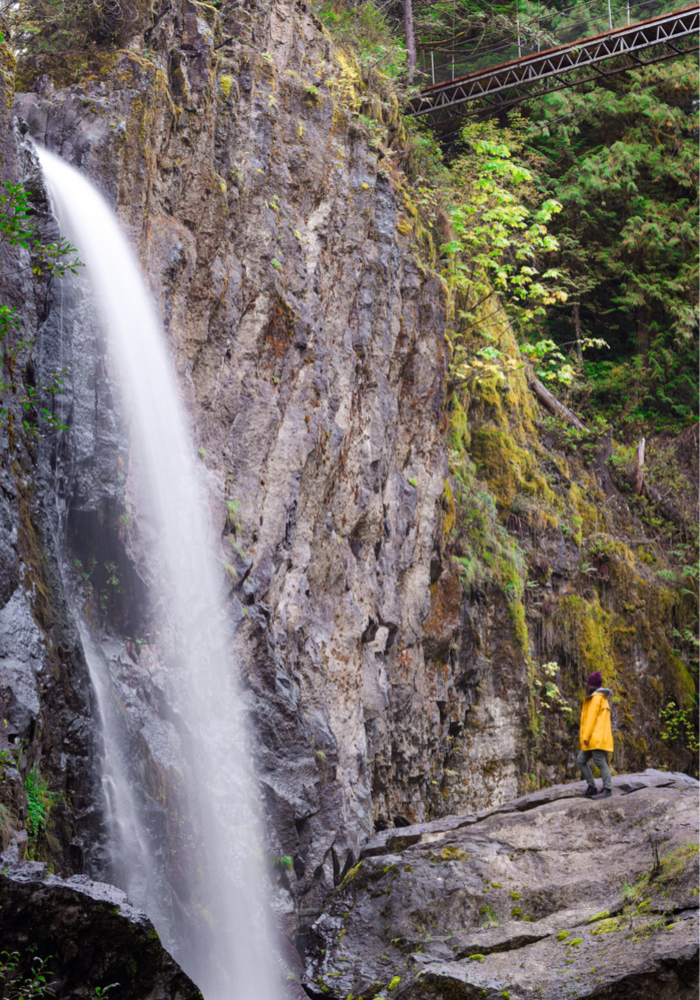
5. Drift Creek Falls Trail
It’s no secret that Drift Creek Falls is epic. In fact, this was probably the busiest trail we’ve ever hiked on the Oregon Coast. But despite my hatred of crowds, this was one of the most beautiful hikes I’ve ever experienced
This short hike takes you through just over a mile of lush rainforest up to a long (we’re talking 250 feet long) suspension bridge. The bridge itself is gorgeous and incredibly sturdy; though you will definitely notice some movement, especially when traffic increases. But you can trust me (girl with crippling fear of heights) – it’s worth it. The view down to the falls is spectacular! And if you make it all the way across, you can hike to the base of the falls for an even closer look.
TRAIL INFO
Distance: 2.6 miles
Elevation: 462 feet
Trail Type: Out & Back
Difficulty: Easy to Moderate
Check Out My Full Drift Creek Falls Guide (including the EASY way to get to the base of the falls) Here!
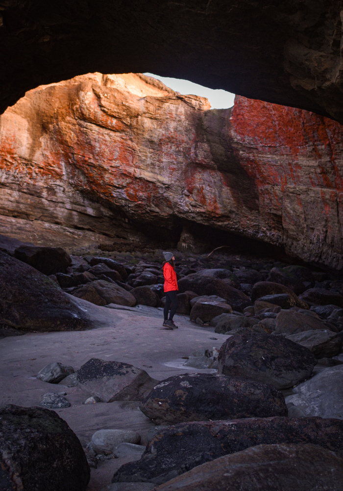
6. Devils Punchbowl Trail
I had seen the Devils Punchbowl before, and it was pretty cool. But that was back when I thought you could only look at it from above. From inside, it is absolutely magical. Definitely in my top 3 favorite Oregon Coast trails!
The hike down to the Punchbowl is unbelievably easy. The hardest part is finding the right trail and, most importantly, timing your visit properly. You’ll want to make sure the tide is way, way out before you stop by. You can check tide tables for the bowl, here. Other than that, it’s mostly straight forward. Just make sure you use the beach trail to the North of the viewpoint and parking lot. There is no access to the Punchbowl from the southerly beach. If you descend a staircase, you’re going the wrong way.
NOTE: Be careful getting inside, as the rocks can be incredibly slippery, and make sure you don’t get stuck as the tide comes back in! Head out as soon as low tide ends.
TRAIL INFO
Distance: 0.5 miles
Elevation: 67 feet
Trail Type: Out & Back
Difficulty: Very Easy

7. Gods Thumb via The Knoll
Okay, let me start by saying, I almost died on this hike. But please don’t let that deter you (or maybe do?). Seriously though, I have very mixed feelings about this hike. While it’s beautiful, it’s extremely strenuous (especially first thing in the morning and before breakfast). The hike is entirely uphill just about until the very end. It’s a lot of elevation in a very short span. And this wasn’t the only issue. Once we reached the Thumb’s viewpoint, we realized there was only one way to actually get to it –
– and it was to descend a very wet, very muddy, very slippery, downhill trail.
I decided to brave the mud hill while my husband stayed up above with Tuna (and the camera). I had to essentially go mud-skiing in my boots for a good portion of the “path” to avoid falling and on the way up I narrowly avoided sliding downhill, several times, by gripping tiny roots buried in the dirt. By the end of it, I was covered in mud and very out of breath. And as it turns out, not really worth it. I couldn’t even get near the top God’s Thumb because the trail was just too steep and sketchy – and you couldn’t see me at all in photos (which as we know, is the only reason for doing anything anymore… jk). Moral of the story: If you don’t get a good photo, at least get a good story. Which I did. So it’s all good I guess.
I didn’t learn until much later, that there is actually a much easier “short cut” trail closer to the coastline. I don’t believe there’s parking at the short cut trail and I did not try this much easier trail, so I can’t verify whether it’s doable. HOWEVER, if I were to do it all again – I think I’d try it out.
If you do take the trail via the Knoll, my recommendations are as follows:
- Don’t go after a heavy rainfall.
- If you do go after a heavy rainfall, stick to the viewpoint and don’t risk your life needlessly (as I always seem to).
- Stop at the Knoll for photos! Because it’s seriously gorgeous (especially at sunrise).
TRAIL INFO
Distance: 4.4 miles
Elevation: 1,007 feet
Trail Type: Out & Back (or loop, if you take the easy trail back)
Difficulty: On the difficult side of Moderate, but officially rated as Moderate 🙂

8. Cape Kiwanda
Cape Kiwanda is one of those coastal stops that I never get sick of. There’s good food, gorgeous views, and plenty of space to wander!
While it might be a bit of a stretch calling this a “hike”, it had to make my list. There’s plenty of cliffs to climb, dunes to slide down, and sea caves to explore. It’s by far my favorite beach on the Oregon Coast!
TRAIL INFO: N/A

9. Hug Point
Hidden caves, beach waterfalls, oh my!
This beach hike is absolutely gorgeous. The rock formations are beautiful and there’s so many cool caves to explore. You’ll find that this is a popular spot at sunset for both tourists and locals, so you’ll have to time your photos right.
TRAIL INFO
Distance: 1.2 miles
Elevation: 78 feet
Trail Type: Out & Back
Difficulty: Very Easy

10. Ecola State Park – Crescent Beach Trail
Crescent Beach Trail is probably the most popular trails in Ecola State Park. It gives you a good mix of beach and forest and has plenty of gorgeous viewpoints along the way (so take your time). Aside from the trail being a bit muddy, this a pretty easy hike. The biggest bonus is, it leads to a secluded beach. Crescent Beach is only accessible by trail, so the chances of you having it to yourself are pretty high (depending on the time of day).
NOTE: There is a $5 fee to park. And before you say “I’ll just park on the street”, forget it. You can’t. I tried because I’m cheap. It’s not allowed and the road is way too narrow and winding anyway.
TRAIL INFO
Distance: 2 miles
Elevation: 488 feet
Trail Type: Out & Back
Difficulty: Easy to Moderate
EXPLORE MORE OF OREGON:
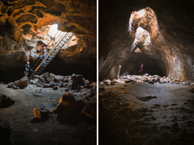
1. BEST CAVES IN BEND OREGON
2. BEST STOPS ON THE OREGON COAST
3. ALVORD DESERT HOT SPRINGS
4. DRIFT CREEK FALLS TRAIL GUIDE
Have any other fave hikes to share with the RR crew? Drop them in the comments!
SHARING IS IN STYLE, GUYS. PIN THIS ARTICLE.
I am surprised you did not include Cape Lookout. The hike (40 min.?) to the lookout is standard Oregon Coast, but the view/dropoff is stunning at the end. Ummm, if you are afraid of heights it may be a little dramatic.